Send the link on. In chat and email, the article title and photo show up with it.
https://mostlyharmless.travel/articles/byzantium
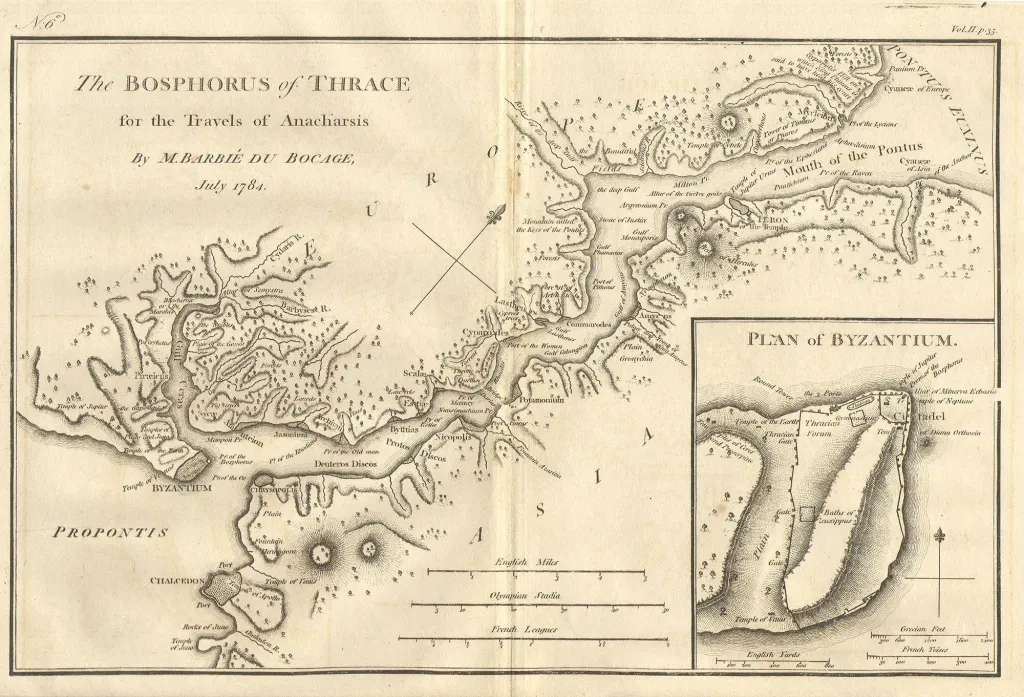
This lovely map, depicting the Bosphorus and the city of Byzantium, was prepared by Jean-Denis Barbié du Bocage in 1784 for the “Travels of Anarcharsis”. The map shows the narrow naval passage from the Propontis (Sea of Marmara) to the Pontus Euxinus (Black Sea). There is a beautiful inset plan of the Horn of Byzantium. Today Byzantium is Istanbul, but the horn and many of the ancient structures still exists. This map also shows the area in considerable topographical detail.
Author: http://www.geographicus.com/mm5/cartographers/bocage.txt, License: Public domain
·
Source
Registration is currently only possible with an invite code. Please enter your invite code or use your personal invite link. If you don't have a code, you can request one from us.
 alpha
NOW FEDERATED!
alpha
NOW FEDERATED!