Send the link on. In chat and email, the article title and photo show up with it.
https://mostlyharmless.travel/articles/larsa
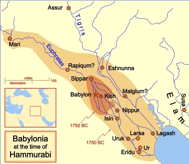
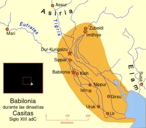
A locator map of Hammurabi's Babylonia, showing the Babylonian territory upon his ascension in 1792 BC and upon his death in 1750 BC. The river courses and coastline are those of that time period -- in general, they are not the modern rivers or coastlines. This is a Mercator projection, with north in its usual position. There is some question to what degree the cities of Nineveh, Tuttul, and Assur were under Babylonian authority. While in his introduction to his code of laws, Hammurabi claims lordship over these cities, Roaf does not include any of these in his map, upon which this map is based, and Chevalas states that "Assur and Nineveh were held for a very few years" (p. 155). Therefore, I have not included them as under Hammurabi's control in 1750 BC. References Bjorklund, Oddvar; Holmboe, Haakon; Rohr, Anders (1970) (in English) Historical Atlas of the World, NY: Barnes & Noble ISBN: 389-00253-4. Chavalas, Mark W. (2003) (in English) Mesopotamia and the Bible, Continuum International Publishing Group ISBN: 978-0567082312. (in English) (2007) Historical World Atlas, Hammond World Atlas Corporation ISBN: 9-780843-71391-6. Roaf, M. (1990) (in English) Cultural Atlas of Mesopotamia and the ancient Near East, Oxford: Facts on File "In general, the basis for the ancient river courses and ancient coastline" Van De Mieroop, Marc (2005) (in English) King Hammurabi of Babylon: A Biography, Blackwell Publishing ISBN: 1405126604.
Author: MapMaster, License: CC BY-SA 4.0
·
Source
Registration is currently only possible with an invite code. Please enter your invite code or use your personal invite link. If you don't have a code, you can request one from us.
 alpha
NOW FEDERATED!
alpha
NOW FEDERATED!