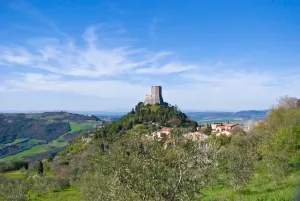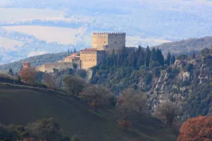
Ripa d'Orcia
hamlet and castle in the territory of Castiglione d'Orcia...
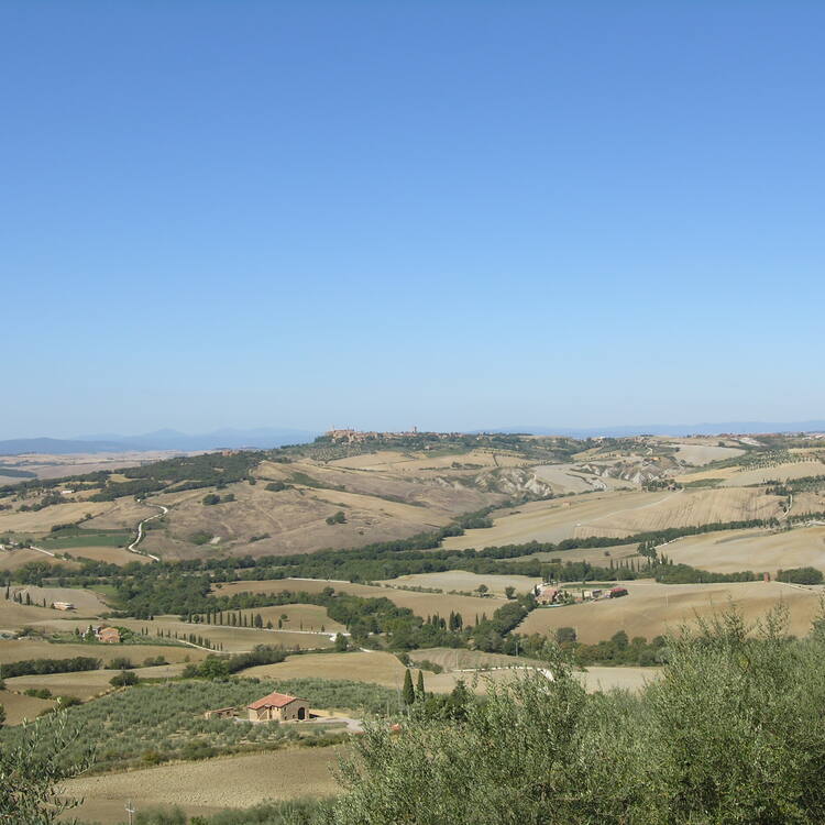
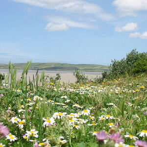
The landscape of Val d’Orcia is part of the agricultural hinterland of Siena, redrawn and developed when it was integrated in the territory of the city-state in the 14th and 15th centuries to reflect an idealized model of good governance and to create an aesthetically pleasing picture. The landscape’s distinctive aesthetics, flat chalk plains out of which rise almost conical hills with fortified settlements on top, inspired many artists. Their images have come to exemplify the beauty of well-managed Renaissance agricultural landscapes. The inscription covers: an agrarian and pastoral landscape reflecting innovative land-management systems; towns and villages; farmhouses; and the Roman Via Francigena and its associated abbeys, inns, shrines, bridges, etc.
Slug: val-dorcia
relatedTo:
isChildOf:
Location:
Created At: Tue Jan 21 2025 19:26:02 GMT+0000 (Coordinated Universal Time)
Updated At: Tue Mar 04 2025 13:34:57 GMT+0000 (Coordinated Universal Time)
Created By:
Version: 1
Status: test_v1
hamlet and castle in the territory of Castiglione d'Orcia...
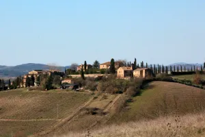
castle in Rocca d'Orcia, Castiglione d'Orcia...
village in the municipality of Buonconvento...
human settlement in Buonconvento, Province of Siena, Tuscany, Italy...
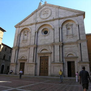
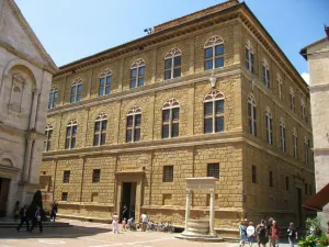
It was in this Tuscan town that Renaissance town-planning concepts...
building in Pienza, Italy...
Situated in the Pacific Ocean some 1,000 km from the...
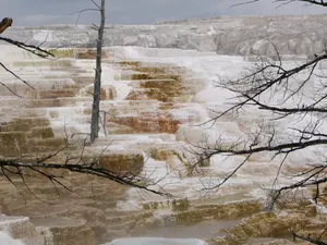
The vast natural forest of Yellowstone National Park covers nearly...
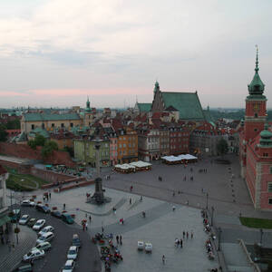
During the Warsaw Uprising in August 1944, more than 85%...
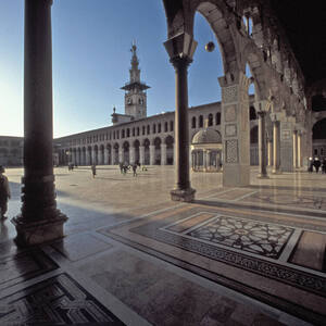
Founded in the 3rd millennium B.C., Damascus is one of...
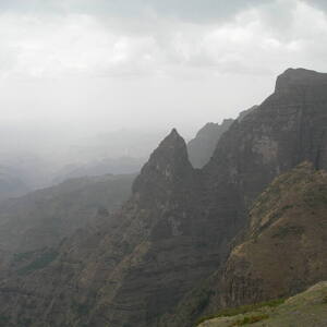
Massive erosion over the years on the Ethiopian plateau has...
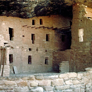
A great concentration of ancestral Pueblo Indian dwellings, built from...