Schick den Link weiter. In Chat und Mail erscheinen Titel und Bild des Artikels.
https://mostlyharmless.travel/articles/kish
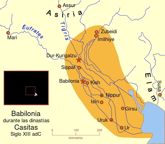
Babilonia durante la dinastía Casita. Siglo XIII a. C. A map of the Babylonian Empire during the time of the Kassites, roughly the 13th century BC. This map shows the probable river courses and coastline at that time.
Author: MapMaster, License: CC BY-SA 4.0
·
Quelle
Registrierung ist derzeit nur mit Einladung möglich. Bitte gib deinen Einladungscode ein oder nutze den persönlichen Einladungs-Link. Falls du keinen Code hast, kannst du einen bei uns anfragen.
 alpha
NOW FEDERATED!
alpha
NOW FEDERATED!